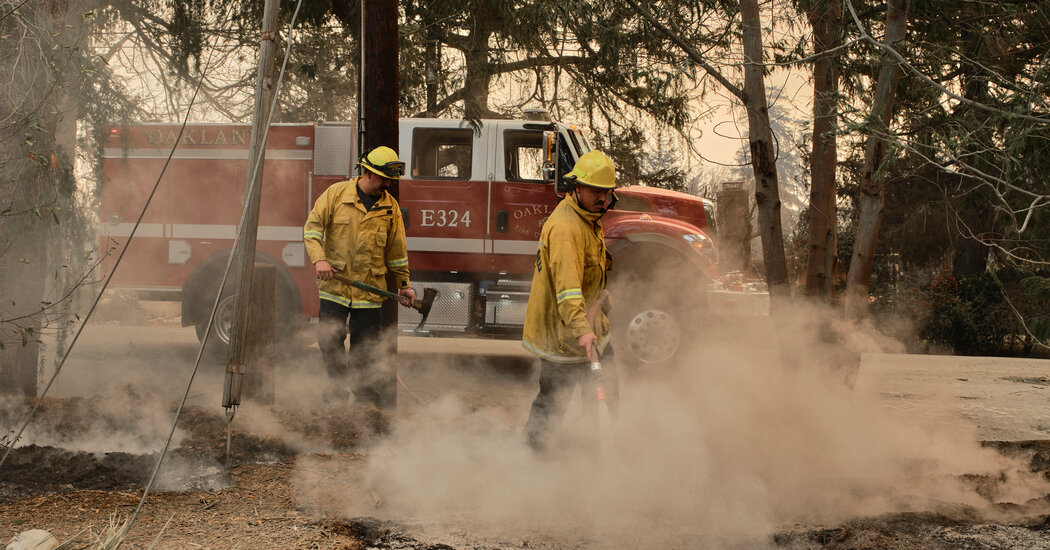
The vegetation was parched, and the air was dry. The worst windstorm in a decade had arrived.
All it would take was a spark.
As a fire ignited in the Pacific Palisades on Tuesday, the winds crashed over and through the mountains like white water rapids. Winds as strong as those in a hurricane propelled the flames through dense urban neighborhoods, and swirling fire whirls danced from home to home, leaving a trail of destruction in their wake.
Since November, the extremely dry vegetation has been blasted by regular Santa Ana winds, sparking first the Franklin fire in November, then the Malibu fire in December, and now this week’s blazes, which are thought to be the most destructive Los Angeles has ever seen. Ahead of each cycle, the National Weather Service has issued a warning for a “particularly dangerous situation,” a newer kind of higher-level alert that was intended to be used only every two to three years.
The current cycle of Santa Ana winds began on Tuesday with the first of four wind events that are expected to continue into next week and likely beyond, fostering fire activity and hampering firefighting efforts.
The second event began Friday morning, and it was expected to diminish by Friday afternoon. It was slightly weaker than the first, but it still brought winds of 80 to 90 miles per hour to the mountains of Southern California.
Afterward, a projected window of about 18 hours of relative calm, which is expected to last into Saturday, may be the best break firefighters have had in helping to contain the outbreak of fires in Los Angeles.
A third round of winds, with gusts about as strong as Friday’s, is expected to last from Saturday into late Sunday morning or early Sunday afternoon.
Even with the slightly weaker Santa Ana wind events, gusts could still spread fires farther, and fire danger will remain elevated.
While the intensity of the winds may ebb and flow over the weekend, with another brief lull projected for Sunday into Monday morning, forecasters are concerned with a fourth wind event that is set to begin on Monday and last through Wednesday.
On Friday afternoon, not all the forecast computer models were aligned on what might happen next, which has produced some uncertainty among the forecasters at the Weather Service’s Storm Prediction Center about the event’s overall intensity and duration next week. The most likely scenario is that a moderate to strong Santa Ana wind event will pick up late Monday and peak on Tuesday.
This event has the potential to be stronger than two before it, but, like them, it is most likely to be what forecasters called a more “classic Santa Ana event,” which the first event was not.
One of the complicating factors of this week’s first windstorm was that, unlike a typical Santa Ana event, it had a slightly more northerly direction, putting the winds perpendicular to the mountains and forcing them to crash over the range like waves smacking large rocks on the seashore. This brought strong winds to areas where they don’t normally occur.
As they pushed through the mountains, the winds also created swirling wind patterns known as eddies, just like water would in a river as it passes a rock. That made the wind swirl on the sheltered side of the mountains, leading blazes like the Eaton fire to burn in an especially erratic pattern. For now, while next week’s winds may be intense, they should follow a more classic path through the region.
While such a series of Santa Ana winds is not uncommon in January, the extreme fire conditions have been worsened by the arid weather that has brought only meager rainfall since last May. Typically, the peak fire season in this region ends with the arrival of rain in the fall.
A sprinkling of rain may finally come toward the end of next week, but if it does, it will likely not be anywhere close to the amount the area would needs to stop the fire danger.


