
Deadly severe weather that spawned tornadoes and dust storms across the Midwest and South arrived on the East Coast on Sunday, bringing with it powerful winds and the potential for tornadoes across the Mid-Atlantic and the Southeast.
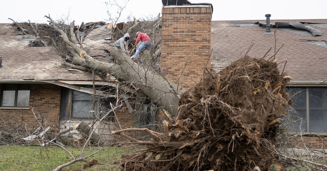
The turbulent weather, which has killed a total of at least 36 people, has caused widespread destruction.
It is part of a huge cross-country system that dropped hail — some as large as baseballs — and produced tornadoes Friday and Saturday that killed at least 23 people. The system also caused wildfires driven by hurricane-force winds, and dust storms that led to crashes that killed at least 13 people in Kansas, Oklahoma and the Texas Panhandle.
On Sunday, the threat of tornadoes and thunderstorms shifted east, though at a level much lower than it was on Saturday.
A complex of storms that was over Alabama, Mississippi and parts of Tennessee on Saturday moved into northern Florida, Georgia, South Carolina and a portion of North Carolina on Sunday morning.
The biggest concern for the Mid-Atlantic, from Virginia to New Jersey, will be strong, damaging winds, but there is also a risk of a few brief tornadoes.
By late Sunday afternoon, parts of Delaware, New Jersey, Pennsylvania, New York, Maryland, Virginia and Washington were under tornado watches and wind advisories. The Weather Service also warned of winds up to 55 miles per hour in Central Florida until 4 a.m. on Monday.
Ground stops were issued at the airports in Tampa and Orlando, Fla., because of the severe storms, causing delays at each airport. There were also flight delays at airports in Washington, New York and Philadelphia because of the weather system, according to the Federal Aviation Administration.
Forecasters said there would be a slight risk of severe storms and tornadoes from Central Florida to western Pennsylvania. However, a higher enhanced risk was in place for western and central Pennsylvania, where over 150,000 power outages were reported on Sunday.
“I’m not expecting the coverage to be as significant and the storms to be as numerous in terms of the overall severity,” said Rich Otto, a meteorologist with the National Weather Service’s Weather Prediction Center. “But there’s still going to be a risk for tornadoes, large hail and damaging winds.”
The heaviest rainfall on Sunday is expected along the East Coast from South Carolina up to Massachusetts, with about one to two inches of rain possible.
A few locations in this area could record up to five inches, particularly in eastern Virginia and eastern North Carolina. New York City could record one to two inches of rain, depending on where thunderstorms are oriented.
This large storm system is expected to move offshore on Monday.
Mr. Otto said there was likely to be a break from the extreme and tempestuous weather for “at least a few to several days” but the overall pattern suggests that more storms will move across the country before the end of March.
“This is probably not the last time we’ll talk about severe thunderstorms in the next several weeks,” he said.
Yan Zhuang and Nazaneen Ghaffar contributed reporting.